

Introduction
This Southeastern Turkey Travel Guide explores a region where early human systems of belief, production, and settlement first took structured form, shaping one of the most historically continuous landscapes in Turkey.
Southeastern Turkey occupies the northern edge of Mesopotamia, a region where early human societies moved beyond subsistence and began to organize space, labor, and belief. For travelers asking what to see in Southeastern Turkey, this region offers a rare continuity where prehistoric sites, early cities and later empires remain visible within the same geographic system.
This landscape does not present isolated historical moments. It preserves a continuous sequence of development in which different phases of human activity accumulate and remain legible. Early communal structures, agricultural systems, trade networks, and later political expressions emerge within the same geographic framework and respond to the same environmental conditions.
From the ritual enclosures of Göbeklitepe to the monumental constructions at Mount Nemrut, this continuity can be observed in material form. What changes across time is not the underlying system, but the way it is expressed.
Within this structure, key urban centers perform distinct roles.
Şanlıurfa reflects the formation of collective belief and early social organization.
Gaziantep operates as a center of production and economic transformation.
Adıyaman presents the monumental articulation of political authority.
Mardin stabilizes continuity through architecture adapted to terrain and long-term settlement.
Taken together, they reveal how this region has been shaped, not through isolated events, but through a continuous interaction between environment, belief, and human organization, a structure that defines this Southeastern Travel Guide.
This structure can be further understood within the broader Turkey Travel Guide, where southeastern Turkey is positioned within the full national route system of regions, transitions and travel logic.

Geography and Rivers: The Framework of Continuity
The southeastern Anatolian landscape is structured by water systems, elevation, and climate, forming a stable framework within which settlement, production, and movement develop.
At its core lie the Tigris River and Euphrates River. These rivers function as primary corridors, linking inland Anatolia to northern Mesopotamia and extending further toward long-distance trade networks. Along their paths, agriculture becomes viable, settlement stabilizes, and exchange gains continuity.
Beyond the river systems, the broader geography reinforces this structure. The volcanic formation of Karacadağ and the surrounding steppe landscapes create conditions defined by limited rainfall and high evaporation. Agricultural production develops within these constraints, favoring crops such as wheat, barley, lentils, grapes, and pistachios.
This environment does not produce surplus through abundance, but through adaptation. Seasonal cycles, soil conditions, and water access determine what can be cultivated and how it is sustained. As a result, production systems remain closely tied to geography, and long-term continuity depends on maintaining this balance.
Across the region, geography does not operate as a background element. It defines the conditions under which all other systems emerge. This geographic framework remains central to understanding any Southeastern Turkey Travel Guide.
Best Time to Visit Southeastern Turkey
Understanding the best time to visit southeastern Turkey is essential for managing heat, visibility, and travel efficiency across open landscapes and archaeological sites.
Seasonal conditions in Southeastern, Turkey are defined by strong contrasts rather than gradual transitions. Seasonal planning is essential when structuring a Southeastern Turkey Travel Guide.
Summers are long, dry, and intense. Across cities such as Şanlıurfa and Gaziantep, temperatures frequently exceed 35°C (95°F), with limited humidity and minimal rainfall. These conditions shape both daily life and movement, particularly in open landscapes and archaeological sites.
Winters are comparatively mild, generally ranging between 5°C and 12°C (41°F to 54°F). Rainfall becomes more frequent, especially in elevated areas, while urban exploration remains accessible throughout the season.
The most balanced periods occur during spring and autumn. Between April and June, and again from September to early November, temperatures stabilize, agricultural activity becomes visible across the region, and outdoor conditions allow for extended exploration.
During these transitional months, the relationship between landscape, settlement, and daily life becomes easier to observe. Fields are active, visibility improves, and movement between destinations is more efficient.
Rather than a single ideal moment, the best time to visit southeastern Turkey aligns with these seasonal transitions, when the region functions at its most accessible and complete.

Şanlıurfa: The Formation of Belief and Collective Structure
Within any Southeastern Turkey Travel Guide, Şanlıurfa represents the earliest layer of human organization. This layer is explored in depth in the Şanlıurfa Travel Guide. This makes Şanlıurfa a central answer to what to see in southeastern Turkey, particularly for travelers focused on early human history and belief systems.
In Şanlıurfa, the earliest phases of organized human activity can be observed not through domestic settlement, but through collective construction.
The site of Göbeklitepe, recognized as a UNESCO World Heritage Site, dated to the 10th millennium BCE, presents a structural model in which large groups of people gathered to build, maintain, and repeatedly use monumental spaces. The circular enclosures, central pillars, and consistent architectural planning indicate coordination, shared intention, and continuity over time.
What distinguishes this phase is the absence of fully developed urban life. Permanent settlement, agriculture at scale, and later economic systems are not yet fully established. Despite this, construction is precise, labor is organized, and space is intentionally defined.
This early layer is further clarified through the collections of the Şanlıurfa Archaeology Museum, where artifacts from Göbeklitepe and surrounding Neolithic sites provide material evidence of this transition. Sculptural fragments, human figures, and symbolic objects demonstrate that abstraction, representation, and shared visual language were already in place at a very early stage.
The landscape of Şanlıurfa preserves this early layer while remaining active in later periods. The sacred setting of Balıklıgöl, the urban fabric shaped in limestone, and the long-standing settlement traditions visible in places such as Harran reflect continuity rather than replacement.
Within this Southeastern Turkey Travel Guide, the earliest forms of collective life take shape in ways that remain visible across the region.

Gaziantep: Production and Economic Continuity
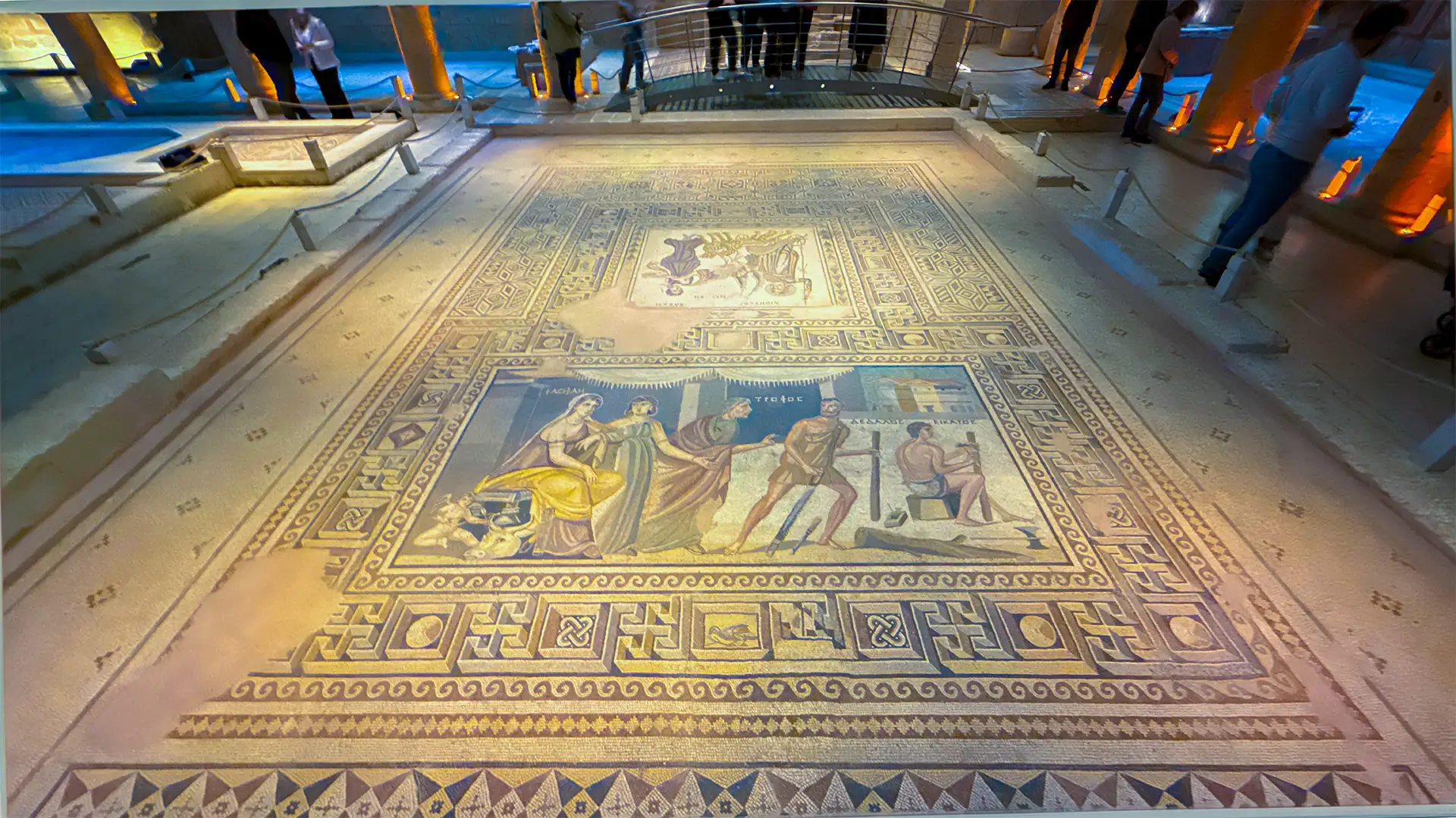
A complete Southeastern Turkey Travel Guide cannot be separated from Gaziantep’s production systems. This structure is detailed in the Gaziantep Travel Guide. For those exploring what to eat in southeastern Turkey, Gaziantep stands as the primary reference point where regional production translates directly into cuisine.
In Gaziantep, the regional system becomes materially visible through production, processing, and exchange.
The surrounding plains provide a stable agricultural base shaped by seasonal cycles and environmental constraint. Wheat, barley, lentils, grapes, and pistachios form the core of this system. These are not isolated outputs. They are part of a continuous chain in which cultivation, transformation, and distribution operate together.
Production in Gaziantep does not end in the field. It extends into the city, where raw materials are refined through established techniques. Culinary traditions emerge from this process, not as separate cultural expressions, but as direct outcomes of agricultural structure. The use of pistachio in desserts such as baklava, the preparation of bulgur-based dishes, and the integration of spices and slow-cooked methods reflect continuity between land and table.
This relationship between resource and transformation is also visible in urban craft. In the historic bazaars, copper work, textile production, and food preparation operate within the same economic logic. Workshops are not independent units. They are extensions of a broader production system that has remained functionally consistent over time.
The recognition of Gaziantep within the UNESCO Creative Cities Network reflects this continuity, but the system itself predates modern classification.
Here, production is not a secondary layer.
It is the mechanism that sustains continuity.
Mardin: Architecture and Urban Continuity
Mardin forms one of the most architecturally consistent components of a Southeastern Turkey Travel Guide. Its urban structure is explored further in the Mardin Travel Guide. For travelers asking what to see in southeastern Turkey beyond archaeological sites, Mardin offers one of the most complete urban experiences shaped by continuity.
In Mardin, continuity is expressed through built form rather than reconstruction.
The city develops along a slope facing the Mesopotamian plains, where topography directly determines urban organization. Structures are not placed independently. They are arranged in terraces, each level supporting the next, ensuring that space, light, and movement remain consistent across the settlement.
This spatial logic produces a unified architectural language. Limestone, locally available and workable, defines both structure and surface. Thick walls regulate temperature, narrow streets control exposure, and courtyards organize private and communal life within a dense urban fabric.
Religious and cultural plurality is integrated into this same framework. Sites such as Mor Gabriel Monastery, historic mosques, and traditional houses operate within the same structural system.
What distinguishes Mardin is not the presence of multiple historical layers, but the way these layers remain structurally aligned.
Within this Southeastern Turkey Travel Guide, continuity is built into the city itself.

Adıyaman: Power and Monumental Expression
Adıyaman introduces the dimension of political symbolism within a Southeastern Turkey Travel Guide.
In Adıyaman, the regional system takes on a visible and intentional form through monumental construction.
Here, political authority is expressed directly in the landscape. The remains of the Kingdom of Commagene demonstrate a deliberate effort to project power, identity, and legitimacy through large-scale architectural intervention.
At Mount Nemrut, a UNESCO World Heritage Site, this intention becomes explicit. The elevated setting, the artificial tumulus, and the arrangement of colossal statues reflect a controlled environment in which rulers position themselves within a symbolic order that extends beyond the human scale.
Nearby locations such as Arsameia and the Kahta region reinforce this pattern, where landscape, inscription, and architecture operate together.
These are not isolated monuments.
They are components of a coordinated system of representation.

Experiencing Southeastern Turkey with Structure
This is where a Southeastern Turkey Travel Guide moves from description into structure.
Understanding southeastern Turkey requires more than visiting individual locations. The region operates through connections that are not always immediately visible. Geography shapes movement, belief defines early organization, production sustains continuity, and architecture preserves this structure over time.
Approaching these elements separately limits what can be understood. What becomes meaningful is the relationship between them.
Travel within this framework is not defined by distance alone, but by sequence and context. Movement between Şanlıurfa, Gaziantep, Mardin, and Adıyaman follows the same structural logic that has shaped the region over time.
Travellers who want to focus entirely on the region can explore it through our Southeastern Turkey Cultural Tour • Göbeklitepe, Mardin & Mount Nemrut, which connects Gaziantep, Halfeti, Şanlıurfa, Göbeklitepe, Mardin and the Commagene landscape within a dedicated regional itinerary.
For those who want Southeastern Turkey to form part of a deeper journey across the country, the 15-Day Turkey Tour • Istanbul, Cappadocia & Mesopotamia begins with Istanbul and four nights in Cappadocia before continuing overland through Gaziantep, Halfeti, Şanlıurfa, Göbeklitepe and Mardin, and concluding with the Kingdom of Commagene and sunrise at Mount Nemrut.
A well-constructed Southeastern Turkey Travel Guide does not isolate destinations. It connects them through continuity.
Travel in southeastern Turkey is not about covering distance. It is about understanding sequence.
When routes follow geography, when time aligns with climate, and when interpretation connects each location, the region reveals its full structure. Without this, it fragments. With it, it becomes one of the most coherent travel experiences in Turkey.
FAQ About Southeastern Turkey
This Southeastern Turkey Travel Guide addresses the most common travel, safety, and planning questions.
What is southeastern Turkey known for?
Southeastern Turkey is known as one of the earliest regions where organized human activity can be observed. Sites such as Göbeklitepe represent early collective construction, while cities like Gaziantep and Mardin reflect long-term continuity in production and architecture.
Which cities should be visited in southeastern Turkey?
The most relevant cities are Şanlıurfa, Gaziantep, Mardin, and Adıyaman. Each represents a different layer of the regional system.
How many days are needed to visit southeastern Turkey?
A minimum of 4 to 5 days is required to follow the main route between key cities while maintaining continuity.
When is the best time to visit southeastern Turkey?
Spring and autumn provide the most balanced conditions. This is why many travelers structure their Southeastern Turkey Travel Guide around these seasons.
Is southeastern Turkey safe for travelers?
The main travel routes operate within established tourism infrastructure. Structured planning ensures a smooth experience.
Is southeastern Turkey safe for tourists?
Yes. Key destinations such as Gaziantep, Şanlıurfa, Mardin, and Adıyaman remain accessible and regularly visited within organized travel frameworks.
What is the best itinerary for southeastern Turkey?
A structured itinerary includes Gaziantep, Şanlıurfa, Mount Nemrut, and Mardin, following geographic and historical continuity.
What to see in southeastern Turkey?
Göbeklitepe, Balıklıgöl, Mount Nemrut, Mardin Old Town, and Gaziantep bazaars form the core of most routes.
What makes Gaziantep cuisine unique?
Cuisine reflects a production-based system rooted in agriculture, where pistachios, grains, and spices are transformed through established techniques.
Why is Göbeklitepe important?
Göbeklitepe demonstrates that organized belief and large-scale construction emerged before urban civilization.
How hot is southeastern Turkey in summer?
Temperatures often exceed 35°C (95°F), especially in Şanlıurfa and Gaziantep.
What should I not do when visiting southeastern Turkey?
Avoid unstructured travel across remote areas and plan routes carefully. The region rewards structured exploration.
Don’t hesitate to contact us to plan a tour in Southeastern Turkey!
WRITTEN BY

Nisa Buket Dağdelen
Operations Director & Tour Guide
LinkedIn Profile

Hüseyin Pekgöz
Founder & Managing Partner
LinkedIn Profile
Adventus Travel Company


