

The Valleys of Cappadocia reveal a side of the region that cannot be fully understood from viewpoints or roadside stops. Walking into these landscapes brings the volcanic terrain closer: narrow passages open beneath sculpted ridges, vineyards occupy sheltered slopes, dovecotes appear high in the rock, and small churches remain concealed along routes once used between settlements.
These valleys belong to a much larger landscape shaped by millions of years of volcanic activity and centuries of human adaptation. For a broader introduction to the region, including its history, major sights, seasonal planning, and cultural landscape, explore our Cappadocia Travel Guide.
What makes hiking in Cappadocia particularly rewarding is that the valleys are not variations of the same scenery. Rose and Red Valleys are closely connected yet change noticeably with geology and light. Pigeon Valley preserves a visible relationship between agriculture and rock-cut architecture, while Love Valley is dominated by some of Cappadocia’s most distinctive erosional formations. Meskendir feels narrower and more sheltered, and Ihlara introduces an entirely different environment shaped around the Melendiz River.
Choosing between them therefore depends on more than distance. Walking time, terrain, exposure, historical interest, photography, and the way individual valleys connect all influence which route makes the most sense.

Continue Exploring Cappadocia
Understand Cappadocia’s Landscape and Heritage
- Cappadocia Travel Guide
- Fairy Chimneys of Cappadocia
- Underground Cities of Cappadocia
- Göreme Open Air Museum
- Ihlara Valley
Plan More Time in Cappadocia
- 10 Things to Do in Cappadocia Beyond Balloons
- Cappadocia Cave Hotels
- Best Workshops in Cappadocia
- Why Visit Cappadocia?
Explore Cappadocia with Adventus
- Highlights of Cappadocia Tour
- Green Tour Cappadocia
- 3 Days Cappadocia Tour
- 5 Days Cappadocia Tour
- Cappadocia Hiking Tour • Valleys & Local Experiences
- Cappadocia’s Nature Tour
Best Valleys of Cappadocia at a Glance
There is no single “best” valley in Cappadocia because each offers a different type of walk. For a first visit, the most useful comparison is not simply which valley is most famous, but what each one is best experienced for.
| Valley | Best For | Character |
|---|---|---|
| Rose Valley | Scenic hiking and rock-cut churches | Layered volcanic slopes, vineyards, hidden churches and changing afternoon light |
| Red Valley | Sunset and dramatic geology | Red and ochre formations, panoramic ridges and excellent connections with Rose and Meskendir |
| Meskendir Valley | A quieter walking route | Narrow passages, tunnels, vegetation and a natural link into the Red and Rose Valley network |
| Love Valley | Fairy chimneys and open scenery | Large erosional pillars and broad views across the landscape |
| Pigeon Valley | Culture, agriculture and scenic walking | Historic dovecotes, vineyards and a natural corridor between Göreme and Uçhisar |
| Ihlara Valley | A longer nature and heritage walk | A deep river canyon with vegetation, rock-cut churches and a different microclimate |
Several of these valleys can also be connected into longer walks rather than experienced independently. This is particularly useful around Rose, Red and Meskendir Valleys, where route choice can considerably change the length, difficulty and endpoint of the hike.
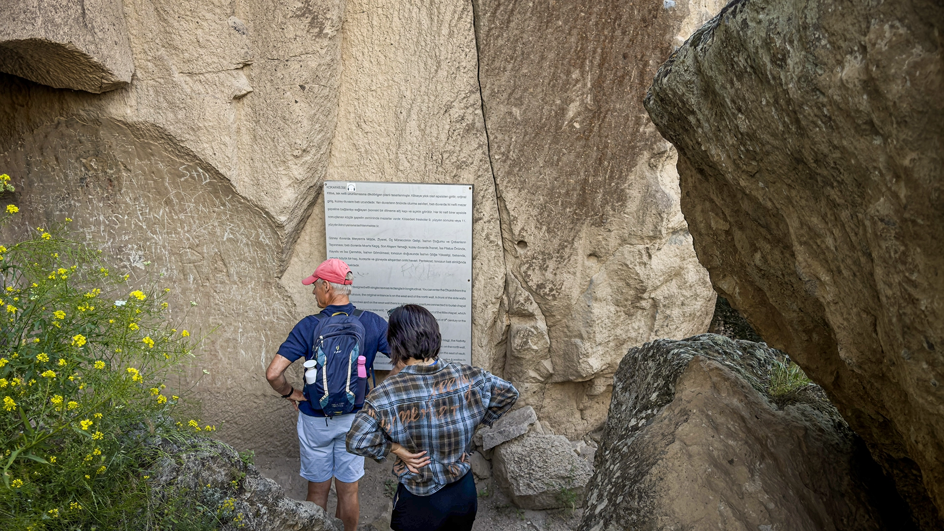
Why the Valleys of Cappadocia Mattered
Long before the valleys of Cappadocia became hiking routes, they were part of the region’s everyday geography. Paths through the valleys connected settlements, agricultural land and places of worship, while their sheltered floors offered conditions very different from the exposed plateau above.
The volcanic landscape also became part of the region’s agricultural system. Vineyards, orchards and cultivated plots developed alongside rock-cut storage spaces, wine presses and dovecotes. In places such as Pigeon Valley, what now appears as a striking pattern of openings across the cliffs was once functional infrastructure: pigeons were kept partly because their manure could be collected and used to enrich cultivated land.
The same adaptability extended beyond agriculture. Soft volcanic rock could be carved into churches, chapels, shelters and working spaces, allowing communities to use the natural terrain rather than simply build upon it. This close relationship between geology and settlement is fundamental to Cappadocia’s identity and forms part of the cultural landscape recognized by UNESCO.
Walking through the valleys today therefore follows a geography shaped by necessity as much as scenery. Trails that now lead between viewpoints often developed within landscapes where movement, cultivation, religious life and settlement had already been interconnected for centuries.
Understanding this changes the experience of hiking in Cappadocia. The valleys are not empty landscapes decorated with historical remains; many of the features encountered along the trail are evidence of how people learned to live within the volcanic terrain itself.
Meskendir Valley
Meskendir Valley is one of the quieter walking routes around Göreme and is best understood as part of the wider network connecting Red Valley and Rose Valley. Rather than opening immediately into broad panoramas, the trail moves through a more enclosed landscape of narrow passages, short tunnels, carved sections and vegetation growing along the valley floor.
This changing sense of enclosure gives Meskendir a character of its own. Some sections feel almost hidden within the volcanic terrain before suddenly opening toward wider views and junctions leading into neighbouring valleys. For hikers planning a longer route, this makes Meskendir especially useful as a natural starting corridor rather than simply an isolated valley to walk from beginning to end.

Hiking Meskendir Valley
The route is generally considered easy to moderate, although the surface is more important than the distance itself. Loose tuff, uneven ground and short descents can slow the pace, particularly after rain or in sections where the trail narrows.
Approximate distance: 4–4.5 km
Typical walking time: around 2.5–3 hours
Difficulty: Easy to Moderate
Best for: quieter hiking, narrow valley scenery and connecting with Red and Rose Valleys
The trail can be completed at a relaxed pace, but many walkers spend longer than expected because Meskendir works naturally as part of a combined route. Continuing toward Red Valley or Rose Valley creates a much richer hike and allows the landscape to change gradually from sheltered corridors to more exposed ridges and panoramic terrain.
What Makes Meskendir Different?
Meskendir does not depend on one famous rock formation or viewpoint. Its appeal comes from the rhythm of the trail itself. Vegetated sections, rock-cut passages and changing light create a more intimate experience than the wider, more photographed valleys nearby.
This also makes it particularly rewarding for travelers who want to walk through Cappadocia rather than simply reach a scenic endpoint. The route reveals how naturally the valleys connect with one another, making it easier to understand Cappadocia as a continuous landscape rather than a collection of separate attractions.
Rose Valley: Cappadocia’s Layered Hiking Landscape
Rose Valley, known locally as Güllüdere, lies between Göreme and Çavuşin and is one of the most rewarding walking areas in Cappadocia. Its appeal comes not from a single formation or viewpoint, but from the way the landscape keeps changing: pale volcanic walls shift toward pink and ochre tones, vineyards appear between the ridges, and rock-cut churches emerge along trails that divide and reconnect through the valley.
One detail that is easy to miss when looking at simplified hiking maps is that Rose Valley is not really one single trail. Local route information separates the area into Güllüdere I and Güllüdere II, with connections toward Meskendir Valley, Red Valley and Çavuşin. This explains why different maps often give different distances and walking times for what they simply label “Rose Valley.”
Hiking Rose Valley
The Güllüdere trail system can be adapted according to available time and the neighbouring valleys included in the walk. Official local signage refers to approximately 4.7 km for the combined Güllüdere I and II system, but a hike can become considerably longer when connected with Meskendir or Red Valley.
Approximate distance: around 4–5 km for the core Rose Valley routes
Typical walking time: approximately 2–3 hours, longer with church visits and connected valleys
Difficulty: Easy to Moderate
Best for: rock-cut churches, changing geology, photography and combined valley hikes
Terrain: narrow paths, short climbs and descents, loose volcanic surfaces and occasional tunnels
The distance alone can be misleading. Short ascents, uneven tuff and trail junctions slow the pace, while church visits and viewpoints naturally add time. Rose Valley is therefore better approached as an exploratory walk than as a route to complete against a fixed schedule.

The Rock-Cut Churches of Rose Valley
The churches hidden along Güllüdere are one of the main reasons Rose Valley deserves more time than a simple sunset walk. On the Güllüdere I branch, the trail reaches Yovakim-Anna Church before continuing toward Direkli, or Kolonlu, Church, an impressive rock-cut space supported by four substantial columns. Current local information notes that access to Yovakim-Anna may be restricted, so the presence of a church on the route should not automatically be understood as guaranteed interior access.
A separate path connects this section with Güllüdere II and the Haçlı Church, revealing how closely the religious sites and walking routes are woven into the same landscape. These are not monuments gathered within a formal archaeological park such as Göreme Open Air Museum. They remain embedded within the terrain, encountered as part of the walk itself.
That difference changes the experience. In Rose Valley, a church may appear after a tunnel, behind a vineyard or within an otherwise unremarkable rock face. The historical landscape is discovered gradually rather than presented all at once.
When Is Rose Valley at Its Best?
Rose Valley becomes especially expressive in the late afternoon, when lower-angle light strengthens the contrast between its pale, pink and warmer-toned rock layers. This is why Rose Valley is frequently combined with neighbouring Red Valley for afternoon and sunset walks.
For hiking, however, sunset should not be the only consideration. Starting earlier provides more time for the churches and secondary paths, while a later walk places greater emphasis on changing light and viewpoints. The better choice depends on whether the priority is heritage, hiking or photography, rather than on a universal “best time.”
Red Valley: Cappadocia’s Most Dramatic Late-Afternoon Landscape
Red Valley, or Kızılçukur, is closely connected with Rose and Meskendir Valleys, but its character is noticeably different. Here, the volcanic layers take on deeper red, rust and ochre tones, particularly as the sun drops lower across the plateau. This combination of exposed geology, elevated viewpoints and a connected hiking route has made Kızılçukur one of Cappadocia’s best-known places for both walking and sunset.
The valley should not be confused with the sunset viewpoint alone. The panoramic terrace above Kızılçukur provides one of the region’s most accessible evening views, while the hiking route descends into a much more complex landscape of rock-cut passages, tunnels, churches and narrow sections before eventually connecting with Meskendir Valley.
Hiking Red Valley
A commonly used route begins near the Kızılçukur sunset viewpoint and descends toward Üzümlü Church before continuing deeper into the valley. From there, the trail passes through several tunnels and more enclosed sections of terrain before joining Meskendir Valley and continuing toward Çavuşin.
Approximate distance: around 5 km to Çavuşin
Typical walking time: approximately 3–4 hours at a relaxed pace
Difficulty: Moderate
Best for: dramatic geology, sunset, photography and combined valley hikes
Terrain: uneven volcanic paths, tunnels, steep descents and occasional ladder-assisted sections
The route deserves more caution than its distance might suggest. Official local hiking information notes several tunnel passages, including one that leads toward a steep descent equipped with metal ladders. For this reason, Red Valley is better treated as a proper hike rather than a casual sunset stroll.

Üzümlü Church and the Cultural Landscape
One of the first significant historical stops along the route is Üzümlü Church, positioned below the upper Kızılçukur area. The church preserves an unusual decorative programme associated with the early medieval Christian landscape of Cappadocia and adds an important historical layer to a route often approached primarily for scenery.
Its location also illustrates a recurring pattern across the Valleys of Cappadocia. Churches were not necessarily separated from movement, agriculture and daily life. They were carved directly into the same terrain through which people travelled and worked, making religious heritage part of the wider landscape rather than an isolated monument.
Red Valley or Rose Valley?
Rose and Red Valleys are often discussed together because their trails connect, but they offer different experiences. Rose Valley is more layered and exploratory, with multiple branches, vineyards and several rock-cut churches distributed through the route. Red Valley feels more dramatic, particularly around its exposed geological formations and late-afternoon viewpoints.
For travelers with enough time, choosing between them is unnecessary. Linking sections of Meskendir, Rose and Red Valleys creates one of the strongest hiking combinations around Göreme and Çavuşin, with the landscape changing repeatedly over the course of a single walk.
Sunset in Red Valley
Kızılçukur is particularly associated with sunset because the low-angle light intensifies the natural reds and ochres already present in the volcanic rock. The upper viewpoint attracts many visitors who come only for the final light of the day, while hikers can experience the same landscape more gradually by approaching the area through the connected valley system.
For those combining walking with sunset, timing matters. Completing the more technical sections before darkness is more important than reaching a particular viewpoint at the last possible moment. The strongest experience is often to finish the main hike first and allow the final part of the afternoon to unfold at a slower pace.

Love Valley: Cappadocia’s Most Distinctive Fairy-Chimney Landscape
Love Valley is best known for the tall, freestanding rock pillars that rise from its broad valley floor. Their unusual form has given the valley its modern nickname, but the landscape itself is a particularly clear example of the differential erosion that created many of Cappadocia’s fairy chimneys.
The main Love Valley discussed by hikers is Bağlıdere, located between Göreme and the Uçhisar side of the central Cappadocia landscape. Official regional tourism sources identify Göreme–Bağlıdere as one of Cappadocia’s principal trekking areas, while GoTürkiye includes Love Valley among the region’s most popular hiking trails.
Hiking Love Valley
Compared with the narrower passages of Meskendir or the interconnected ridges of Rose and Red Valleys, Love Valley feels considerably more open. The trail passes directly beneath clusters of tall erosional pillars, allowing their scale to be appreciated from the valley floor rather than only from the panoramic viewpoints above.
Difficulty: Easy to Moderate
Best for: fairy chimneys, open landscapes and photography
Terrain: mostly open dirt trails with uneven volcanic surfaces
Walking style: particularly suitable for a relaxed scenic hike rather than a technically demanding route
Exact walking distance depends on the chosen entrance and exit point, which is why route descriptions for Love Valley often vary. For practical planning, it is more useful to decide first whether the aim is to walk through the valley itself, connect toward the Uçhisar side, or simply visit one of the viewpoints overlooking the formations.

Why Do the Fairy Chimneys Look Different Here?
The formations in Love Valley demonstrate the same broad geological process responsible for fairy chimneys elsewhere in Cappadocia, but erosion has produced unusually tall and isolated pillars in this particular corridor. Softer volcanic material was gradually removed by wind and water while more resistant sections survived longer, leaving the vertical forms visible today.
Their appearance may be the reason Love Valley receives so much attention, but seeing them from the trail reveals something photographs often flatten: their scale. From the valley floor, individual pillars rise above the walking path while larger eroded walls form the background, making Love Valley feel more spatially open than many neighbouring valleys.
A Useful Note About the Name “Love Valley”
Travelers may occasionally encounter another Cappadocia valley labelled Love Valley on maps, tours or local descriptions. This is because Görkündere Valley, closer to Göreme and the Zemi Valley area, is also locally referred to as Aşk Vadisi. It is a much shorter walking area, with KAPHİB describing a route of roughly one kilometre that normally returns through the same entrance.
The larger Bağlıdere Love Valley is the one generally associated with the famous tall fairy chimneys and the principal hiking landscape described in this guide. Making that distinction is useful when comparing online maps or arranging trailheads, since the same English name can otherwise point to two different locations.
Pigeon Valley: Where Agriculture Was Carved into the Rock
Pigeon Valley, or Güvercinlik Vadisi, connects Göreme with Uçhisar through one of Cappadocia’s most historically revealing landscapes. The route is scenic, but its real significance lies in the hundreds of dovecotes carved into the valley walls, evidence of a practical agricultural system that linked the volcanic landscape with vineyards, orchards and cultivated land.
Unlike Love Valley, where the geology dominates the experience, or Red Valley, where colour and exposed ridges shape the walk, Pigeon Valley tells a more human story. The landscape shows how local communities adapted Cappadocia’s rock not only for shelter and worship, but also for agricultural production.
Hiking Pigeon Valley
The principal route runs between Göreme and Uçhisar, making Pigeon Valley one of the easiest valleys to integrate into a day exploring central Cappadocia. Walking from Göreme toward Uçhisar has a particular visual advantage: the trail gradually approaches Uçhisar Castle, which rises above the landscape and becomes increasingly dominant as the walk progresses.
Approximate distance: around 4 km
Typical walking time: approximately 2.5–3.5 hours at a relaxed pace
Difficulty: Easy to Moderate
Best for: dovecotes, agricultural history, Uçhisar views and a moderate scenic walk
Terrain: valley-floor paths, uneven volcanic surfaces and short elevation changes
The route is not technically demanding, but walking times vary considerably according to pace, photography stops and trail conditions. As elsewhere in Cappadocia, distance alone does not fully represent the experience.
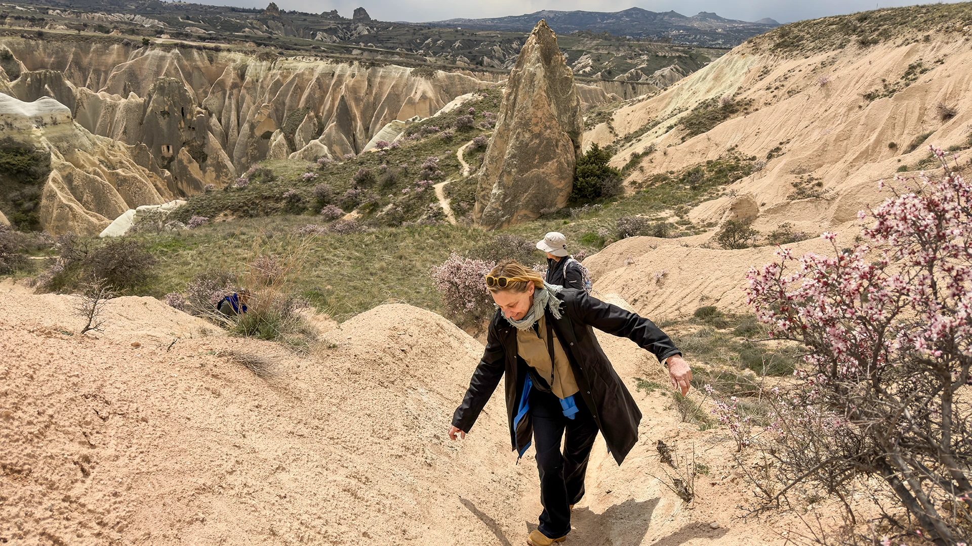
Why Are There So Many Dovecotes in Pigeon Valley?
The dovecotes that give the valley its name were not created simply to keep birds. Pigeon manure was collected and used as a valuable natural fertilizer, particularly in vineyards and cultivated plots growing within Cappadocia’s volcanic soils.
Many dovecotes were carved high into rock faces where pigeons could enter through small openings while the interior remained protected. Their façades were sometimes treated with white lime, helping make the entrances more visible to birds. Carved access points and interior chambers allowed local communities to maintain the structures and collect the accumulated manure.
This relationship between pigeons and agriculture was not unique to Pigeon Valley, and dovecotes survive throughout Cappadocia. Here, however, their concentration makes the system especially easy to read within the landscape.
Vineyards, Orchards and the Valley Microclimate
The agricultural importance of Pigeon Valley also depended on the physical environment surrounding the dovecotes. Sheltered sections of the valley reduce exposure to the winds of the plateau, while the terrain helps create small pockets where vineyards, fruit trees and cultivated plots can survive within an otherwise dry volcanic landscape.
Cappadocia’s long relationship with viticulture is therefore connected not only to volcanic soil, but also to the way individual valleys created usable agricultural environments. Dovecotes, vineyards and carved storage spaces were different parts of the same working landscape rather than unrelated features.
This is an important distinction when walking through Pigeon Valley today. The vineyards and carved openings visible along the route are traces of a system in which the valley itself functioned as agricultural infrastructure.
Walking from Göreme to Uçhisar
For hikers choosing between directions, the Göreme to Uçhisar route offers one of the most satisfying visual sequences. Uçhisar Castle first appears in the distance and gradually becomes the dominant landmark as the trail approaches the village.
Finishing in Uçhisar also creates a natural opportunity to continue toward the viewpoints surrounding the castle or combine the walk with other parts of central Cappadocia. In the opposite direction, the route provides a gradual descent toward Göreme and easier connections with the wider network of valleys surrounding the town.
Pigeon Valley is therefore more than a convenient trail between two settlements. It is one of the clearest places in Cappadocia to see how geology, agriculture and human adaptation became part of the same landscape.

Ihlara Valley: A River Canyon in Southern Cappadocia
Ihlara Valley belongs to the wider Cappadocian landscape, yet walking through it feels very different from hiking around Göreme. Instead of open ridges and dry volcanic corridors, the trail follows the Melendiz River through a deep canyon filled with trees, cultivated land and rock-cut churches.
The valley extends for approximately 14 kilometres through southern Cappadocia in Aksaray Province. Over time, the Melendiz River cut deeply into volcanic deposits, creating steep canyon walls and a sheltered environment that developed its own distinctive vegetation and microclimate.
This permanent source of water is one of the keys to understanding Ihlara. While many of Cappadocia’s other valleys reveal adaptation to a dry plateau environment, Ihlara supported a much greener and more sustained landscape of settlement, cultivation and religious life.

Hiking Ihlara Valley
Ihlara should not be treated as one standard hiking route. The complete valley is approximately 14 kilometres long, but most visitors explore only a section of it. Belisırma provides an important access and exit point around the middle of the valley, making shorter walks possible without committing to the full traverse.
Full valley length: approximately 14 km
Difficulty: Easy to Moderate in terrain, but demanding when walked in full
Best for: longer hiking, river scenery, rock-cut churches and a greener side of Cappadocia
Terrain: riverside paths, bridges, stairs, shaded sections and uneven natural trails
The distinction between terrain difficulty and physical effort is important. Much of the trail itself is relatively gentle, but a complete crossing becomes a substantial day because of its length, church visits and access logistics. Local regional guidance recommends allowing most of a day for hikers attempting the entire valley rather than estimating the experience from distance alone.
For many travelers, a sectional walk ending around Belisırma offers a better balance between nature, historical sites and available time.
A Landscape Shaped by the Melendiz River
The presence of flowing water changes almost every aspect of Ihlara. Trees grow densely along sections of the river, shade is more common than in the exposed valleys around Göreme, and vineyards and gardens appear within the protected canyon environment.
The river also determined patterns of settlement. Rock-cut spaces developed along the canyon walls while agricultural activity remained close to the water below. Churches, dwellings and productive land therefore existed within the same narrow geographical corridor.
This makes Ihlara an important contrast within the Valleys of Cappadocia. Rose, Red and Meskendir reveal how communities adapted to exposed volcanic terrain; Ihlara shows what became possible where that same geology was combined with a permanent water source.
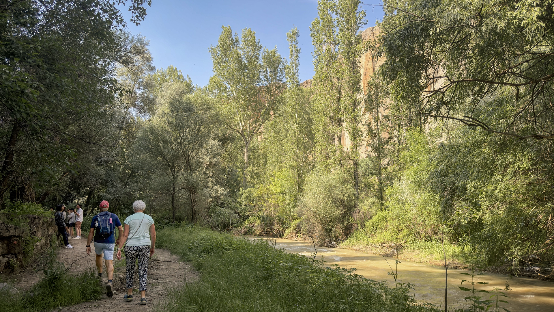
The Rock-Cut Churches of Ihlara Valley
Ihlara also preserves one of Cappadocia’s most extensive concentrations of rock-cut religious architecture. Churches and chapels appear along both sides of the canyon, some close to the main entrances and others requiring detours from the riverside path.
Among the best-known are Ağaçaltı Church, Yılanlı Church, Sümbüllü Church and Kokar Church, while additional churches continue toward Belisırma and the northern sections of the valley. Their presence reflects the importance of Ihlara as a Christian religious landscape, particularly during the Byzantine period.
Unlike Göreme Open Air Museum, where a concentrated group of churches can be explored within a defined archaeological site, Ihlara distributes its religious architecture across kilometres of canyon. The relationship between monument and landscape is therefore experienced through movement: walking, crossing the river and gradually encountering carved spaces along the route.
Ihlara to Belisırma or the Full Valley?
For most first-time visitors, this is the most useful planning question.
A shorter route through the central part of Ihlara provides the characteristic riverside scenery and access to several important churches without turning the visit into a full-day trek. Belisırma is particularly useful because it functions as a natural stopping point and provides road access outside the canyon.
Walking the entire valley, by contrast, should be approached as a dedicated hiking day. The distance itself is only part of the calculation. Church visits, photography, rest stops, the initial descent into the canyon and transport arrangements at the other end all add considerably to the total time.
Neither approach is inherently better. The right choice depends on whether Ihlara is being included as one element of a wider Cappadocia day or whether the valley itself is the principal hiking experience.

Choosing the Right Valley in Cappadocia
No single valley represents Cappadocia on its own. The better question is which landscape best matches the type of experience being planned.
For first-time hikers, Rose Valley offers one of the strongest introductions because it combines varied terrain, rock-cut churches, vineyards and easy connections with neighbouring valleys. Those prioritizing dramatic late-afternoon light and panoramic geology will usually find Red Valley more rewarding, particularly when the walk is planned to finish before sunset.
Meskendir Valley suits travelers looking for a quieter and more enclosed route, especially when it is used as part of a longer walk into Rose or Red Valley. Love Valley places greater emphasis on Cappadocia’s distinctive fairy-chimney formations and works well for those who prefer open scenery and a less heritage-focused walk.
For travelers interested in how local communities adapted the landscape for agriculture, Pigeon Valley provides the clearest connection between dovecotes, vineyards and the historic route linking Göreme with Uçhisar. Ihlara Valley, meanwhile, should be considered separately from the central Cappadocia valleys: its river canyon, vegetation, churches and longer walking distances make it better suited to travelers who want a more substantial nature and heritage experience.
Which Valley Is Best for What?
- Best all-round hiking experience: Rose Valley
- Best for sunset and dramatic geology: Red Valley
- Best for a quieter connected trail: Meskendir Valley
- Best for fairy chimneys: Love Valley
- Best for agricultural and cultural landscape: Pigeon Valley
- Best for a longer nature walk: Ihlara Valley
Time also matters. With only a few hours available, concentrating on one central valley generally creates a better experience than trying to combine several routes. With half a day, Rose, Red and Meskendir can be connected more intelligently. Ihlara is better treated as a separate excursion because reaching the valley and arranging the hiking route require more logistical planning.
The strongest Cappadocia hiking plan is therefore not the one that includes the greatest number of valleys. It is the one in which terrain, available time and individual interests are matched realistically.
Practical Considerations for Hiking the Valleys of Cappadocia
Distances in Cappadocia can be deceptive. A route that appears short on a map may include loose volcanic surfaces, sudden elevation changes, narrow passages or trail junctions that significantly increase walking time. For this reason, hiking plans should be based on terrain and route structure rather than distance alone.
Proper footwear matters more than technical hiking equipment on most central Cappadocia trails. Shoes with reliable grip are preferable on loose tuff and uneven ground, particularly in Rose, Red and Meskendir Valleys. After rain, shaded sections can become slippery, while winter conditions may introduce ice or snow on exposed slopes.
Water, Heat and Seasonal Conditions
Many valley routes have limited or no reliable services once the walk begins, so carrying sufficient water is essential. During summer, the exposed sections of Red, Love and parts of Rose Valley can become particularly hot around midday, with relatively little shade.
Spring and autumn generally provide the most comfortable conditions for longer hikes. Winter can be exceptionally beautiful, but snow and ice may change the difficulty of otherwise straightforward paths. Seasonal weather should therefore be considered as part of route selection rather than simply as a question of what clothing to wear.
Trail Markings and Navigation
Cappadocia’s main valleys are well established walking areas, but they do not always function like formally managed hiking trails with continuous standardized signage. Paths divide, reconnect and occasionally lead toward vineyards, churches or neighbouring valleys.
This is especially important around the Meskendir, Rose and Red Valley network, where several routes can be combined. Offline mapping can be useful, but it should not replace awareness of the terrain and the intended exit point.
A simple rule helps: know where the walk begins, where it should end and how the return will be handled before entering the valley.
Planning a Sunset Hike
Sunset is one of the most rewarding times to experience Cappadocia’s valleys, particularly around Red and Rose Valleys, but it also introduces one of the most common planning mistakes. The landscape may remain illuminated while the valley floor and narrow passages become dark much earlier.
The technical or unfamiliar sections of a route should therefore be completed before daylight fades. For longer sunset hikes, arranging transport from the endpoint can be more practical than attempting to retrace the route after dark.
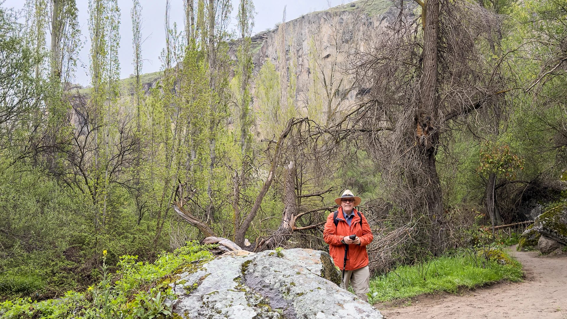
Hiking Independently or with a Guide
Many of Cappadocia’s valleys can be explored independently by experienced and well-prepared walkers. A guide becomes more valuable when the route includes multiple connected valleys, rock-cut churches or historical features that are easy to pass without recognizing their significance.
The difference is not simply navigation. Understanding why dovecotes were carved into cliffs, how vineyards developed within sheltered valleys or why churches appear along particular corridors changes the walk from a scenic route into an interpretation of Cappadocia’s cultural landscape.
For travelers interested in combining hiking with the wider history, villages and archaeological sites of the region, a privately planned route can also help balance walking time with the rest of a Cappadocia itinerary.
Exploring the Valleys with Adventus
The valleys of Cappadocia rarely need to be treated as separate sightseeing stops. The more rewarding approach is often to connect walking routes with the historical and cultural sites surrounding them, while allowing enough time for the landscape itself.
With Adventus, valley walks can be adapted according to walking ability, season, available time and individual interests. A shorter route might combine Pigeon Valley or Red Valley with Cappadocia’s principal heritage sites, while travelers who prefer hiking can dedicate more time to connected routes through Meskendir, Rose and Red Valleys. Ihlara requires a different approach, with its longer canyon walk and transport logistics planned around the chosen entry and exit points.
Travelers with limited time can explore the region through our Highlights of Cappadocia Tour, while longer itineraries such as 3 Days Cappadocia Tour and 5 Days Cappadocia Tour allow walking, archaeology, villages and local culture to be distributed more naturally across several days.
For travellers who want walking to become the main structure of their Cappadocia stay, the Cappadocia Hiking Tour • Valleys & Local Experiences offers a more hiking-focused five-day route. Longer walks through Ihlara Valley and Avla Canyon are combined with Red, Swords and Görkündere valleys, while Kaymaklı Underground City, Göreme Open Air Museum, Soğanlı Valley, Paşabağ and Zelve keep the itinerary connected to Cappadocia’s cultural landscape.
For those interested in landscapes beyond Cappadocia’s classic volcanic valleys, our Cappadocia Nature Tour continues into Erdemli Valley, the Aladağlar Mountains, Kapuzbaşı Waterfalls and Sultan Marshes, revealing a very different side of the wider Central Anatolian environment.
The aim is not to include as many valleys as possible. It is to choose routes that make sense together and leave enough time to understand the landscape being crossed.

Travellers who want to experience Cappadocia’s valleys within a longer journey across Turkey can include Red Valley as part of the 15-Day Turkey Tour • Istanbul, Cappadocia & Mesopotamia. The itinerary allows four nights in Cappadocia, combining a sunset walk in Red Valley with Kaymaklı Underground City, Göreme Open Air Museum, Mustafapaşa, Keşlik, Sobesos and Soğanlı before continuing overland toward Gaziantep and Southeastern Turkey.
FAQ About the Valleys of Cappadocia
Which valley is best for hiking in Cappadocia?
For a first-time hike, Rose Valley offers the strongest overall balance of scenery, rock-cut churches and varied terrain. Red Valley is better for dramatic geology and sunset, while Meskendir works particularly well as part of a connected route through several valleys.
Which Cappadocia valley is best for sunset?
Red Valley, or Kızılçukur, is the strongest choice for sunset because its exposed volcanic layers take on deeper red and ochre tones in late-afternoon light. Rose Valley is also excellent at this time of day, especially when both valleys are combined in one hike.
Can the valleys of Cappadocia be explored without a guide?
Yes. Many of the main valleys can be explored independently by experienced walkers who are comfortable with uneven terrain and basic route navigation. A guide becomes more useful when combining several valleys or when historical features such as churches, dovecotes and agricultural structures are an important part of the experience.
How difficult are the hiking trails in Cappadocia?
Most central Cappadocia valley walks fall within the easy to moderate range, but difficulty depends more on terrain than distance. Loose volcanic surfaces, short climbs, narrow passages and changing elevation can make apparently short routes more demanding than expected.
How much time should be allowed for hiking in Cappadocia?
A single valley usually requires around 2 to 4 hours, depending on the route, walking pace and number of stops. Connected hikes through Meskendir, Rose and Red Valleys can take half a day, while Ihlara Valley should be planned separately because longer sections require more time and transport coordination.
What is the best season for hiking the valleys of Cappadocia?
Spring and autumn generally offer the most comfortable conditions for longer walks. Summer can be hot and exposed around midday, while winter may introduce snow, ice and slippery trail conditions. Early morning and late afternoon are usually preferable during warmer months.
WRITTEN BY

Nisa Buket Dağdelen
Operations Director & Tour Guide
LinkedIn Profile

Hüseyin Pekgöz
Founder & Managing Partner
LinkedIn Profile
Adventus Travel Company


